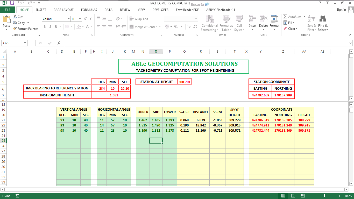
Tacheometry is the branch of Surveying in which the horizontal and vertical distances with the angular measurements are determined with an instrument (Tachemometer). It is not so accurate method of finding the horizontal distances as the Chaining is, but it is most suitable for carrying out the surveys to find the distances in the hilly area where other methods are quite difficult being carried out. It is generally used to locate contours, hydrographic surveys and laying out routes of highways, railways etc. This program For reduction of stadia hair field observations and calculation of spot heights (E,N,H)


Copyright ©Dural Informatics All Rights Reserved.
Dural Informatics is more than a surveying firm, we are guardians of your investment dreams. Founded by registered professionals with years of hands-on experience, we have worked across residential estates, commercial hubs, agricultural layouts, and government-backed projects